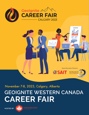
EXPO REGISTRATION IS OPEN

NOV 7-8, 2023

November 6-8, 2023 | Calgary, Alberta, Canada
The Big Four Roadhouse in the BMO Centre
Day(s)
:
Hour(s)
:
Minute(s)
:
Second(s)
Canada’s Geospatial Technology Exposition
WORKSHOPS
EXHIBITORS
Education Sponsors
Supporting & Participating Associations
Media & Event Sponsors
Download our Participant Packages
Featured Speakers

Gavin Schrock
Land Surveyor
Consulting Editor for GoGeomatics
Gavin Schrock is consulting editor of GoGeomatics Magazine, a publication focused on the Canadian geomatics sector. Gavin is a practicing, licensed land surveyor, technology writer, and administrator of a cooperative real-time GNSS network. He has worked in surveying, mapping, geodesy. Monitoring, data management, radio navigation, and GIS for over three decades in public works, commercial development, defense, and utilities. He has published in these fields and has taught these subjects at local, state, national, and international conferences.

Maude Pelletier
Owner and President
Balko Technologies
Maude Pelletier is an accomplished professional in the field of geomatics. She has a varied know-how on available technologies and multiple methods of geospatial data capture. With more than 7 years of experience in lidar data acquisition and aerial imagery by drone, she has a unique perception of the digital future of this market, the revolution in technologies and the future direction of geomatics. She is the founder and CEO of two companies working in the field of geomatics: MVT Geo-Solutions Inc., a company specializing in the capture and processing of geospatial data and Balko Technologies, a manufacturing company that develops and builds lidar sensors for drones.
Discover our impressive array of speakers
Expo Education Partners
Another strong factor inaugurating this event in Calgary is the city boasts two of the largest and most successful geomatics education programs in Canada. The University of Calgary, Schulich School of Engineering, Geomatics Engineering is one of only three Canadian schools at the university level offering this advanced and specialized education. The other program is the Southern Alberta Institute of Technology (SAIT), Geomatics Engineering Technology, and the Bachelor of Applied Technology Geographic Information Systems.
The Expo is working closely with both schools to create opportunities for leadership, learning, and engagement for students, faculty, and partners by bringing a premier-level trade show to Calgary.
Statement of Support
The Geomatics Engineering Students’ Society at the University of Calgary
The Geomatics Engineering Students’ Society at the University of Calgary strongly supports the GoGeomatics Expo in Calgary. As a student-run council, we work to support the learning experience for Geomatics Engineering students and we are confident that the GoGeomatics Expo provides a wonderful opportunity for our members to learn, share, and explore the world of geomatics. The University of Calgary Geomatics program is one of the strongest programs in Canada and the Geomatics Engineering Students’ Society is proud to participate in the Expo as it will provide opportunities for our members to gain leadership, learning, and engagement opportunities. Our students graduate with qualifications and skills to work in a broad range of roles, and an expo like this will open our eyes to different applications that we may have overlooked. We are excited for this opportunity to explore the innovative dynamic Geomatics Sector in North America.
The Department of Geomatics Engineering in the Schulich School of Engineering
The Department of Geomatics Engineering in the Schulich School of Engineering welcomes the Geomatics Expo 2023 to the heart of our city, a renowned hub for Geospatial Technologies. Location technologies such as sensors and IoT, unmanned aerial vehicles (UAVs), mobile robots, 3D imaging systems, remote sensing, satellite navigation, and AI for big geospatial data can help us map our planet and navigate the challenges and opportunities of our interconnected world. Our students, researchers and academic staff are looking forward to being inspired by the latest developments and tools demonstrated at the inaugural tradeshow.
Southern Alberta Institute of Technology (SAIT)
Components of the geomatics industry have been taught at SAIT since 1918. One famous image of SAIT’s Heritage Hall has a land surveying class out front. SAIT’s Geomatics Engineering Technology program has morphed and developed into one of the largest programs in Canada today. Bringing a world-class Geomatics Expo to Calgary spotlights the innovation and strength of our industry, in western Canada and beyond. The energy, resource, construction and legal industries (to name a few) use geomatics services and products. A locally held expo will provide those industries with networking opportunities while they experience the latest innovations and services available all in one location. The Expo also invigorates conversation about careers in geomatics and works to attract top talent to the industry. This event is an exceptional opportunity for prospective and current students, and industry to network and showcase geomatics.
SAIT Geomatic Engineering Technology Club (GNT)
SAITs Geomatics club supports the GoGeomatics Expo in Calgary. At SAIT we are always trying to broaden the horizons for the future of geomatics, and we believe that the opportunity to have a Geomatics Expo in Calgary is a fantastic chance to help show both students and public the world of Geomatics. We hope the event sheds light on the diverse nature of our studies to many other individuals as it already has to us. The Geomatics community has much to offer, and we hope that this event is the first of many to be held in Calgary. The SAIT Geomatic Engineering Technology Club (GNT Club) is fully supportive of this event and wishes it all the best in terms of success.
Industries Served

Digital Twins

Autonomous Systems (Vehicles, Drones, and other Machinery)

Engineering

GIS

Indoor Mapping

LIDAR

Dealer / Distributor

Mapping / Cartography

Reality Capture

EO & Remote Sensing

Underground Infrastructure

Surveying

Utilities

Federal Governement / State / Municipal / Military

GNSS

Hydro / Marine / Bathymetry

BIM / Construction

Monitoring

IOT Machine Control

Transportation

Education

Manufacturing

Agriculture


